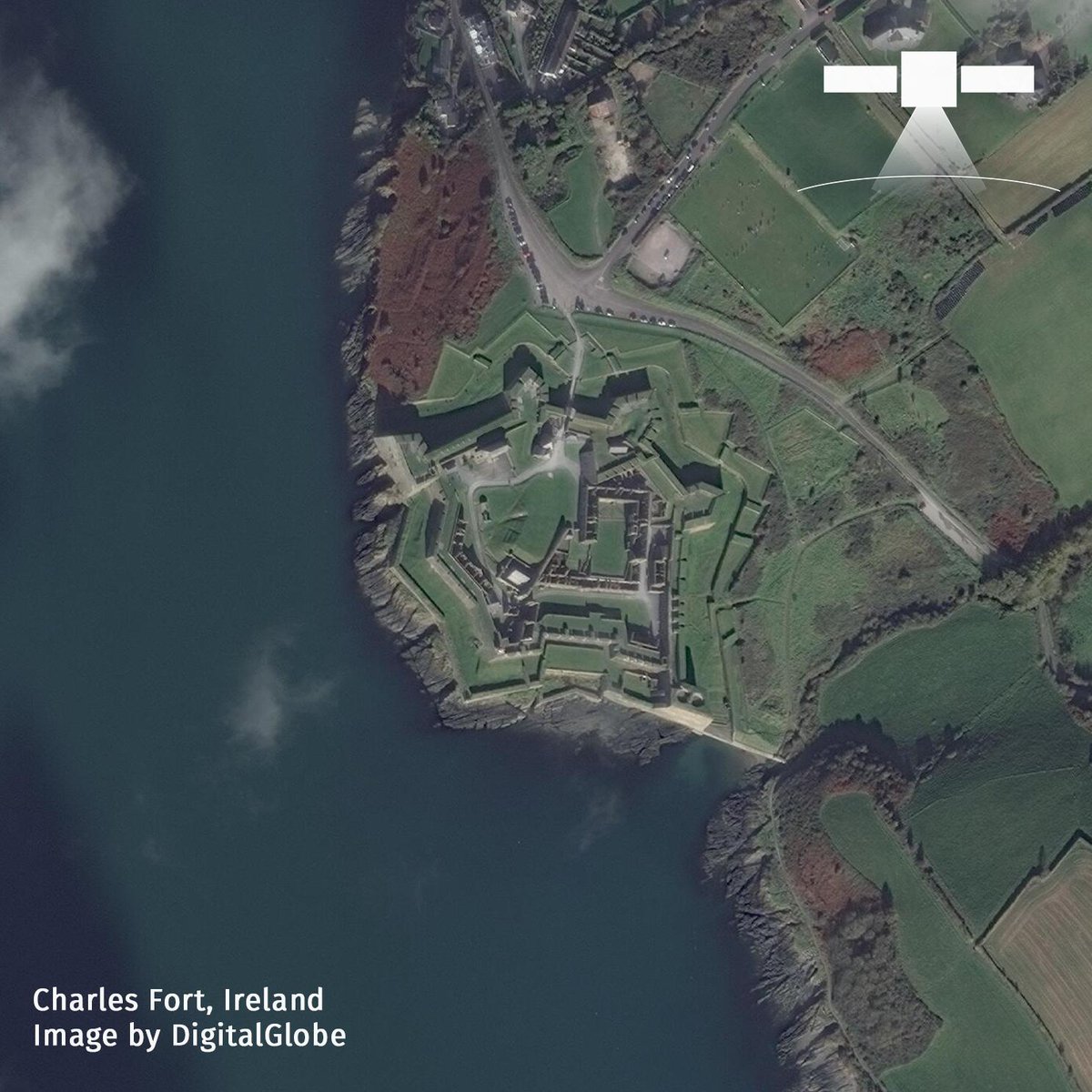
Happy St. Patrick's Day from Ireland! Charles Fort is a bastion fort with one section of the curtain wall built in star fashion. It is located on the water's edge, at the southern end of the village of Summer Cove, on Kinsale harbor. #StPatricksDay  #ireland #satelliteimagery pic.twitter.com/M3VyAzyYul
from SpyMeSat https://twitter.com/SpyMeSat/status/1107287976952954880
via https://twitter.com/SpyMeSat